Geography of Ethiopia
Total Area: 1,127,127 Sq. Km
Land Area: 1,119,683 Sq. Km
Water Area: 7,444 Sq. Km
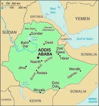
Highest Elevation: Ras Dashan, 4,533 m
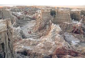
Lowest Elevation: Danakil Depression, 125m
Total Distance of all Land Boundaries: Landlocked
Total Distance of All Land Boundaries: 5,238 Km
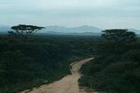
The climate of Ethiopia is generally mild, but it can be 140 degrees Fahrenheit or as cold as 68 degrees. The terrain of Ethiopia is divided by the Rift Valley with the Simien and Bale Mountains. Ethiopia borders Somalia, Kenya, Eritrea, Djibouti, and Sudan. In comparison to the United States, it's smaller by 8,699,873 Sq. Km. It's about three times the size of Montana.
Land Area: 1,119,683 Sq. Km
Water Area: 7,444 Sq. Km
Highest Elevation: Ras Dashan, 4,533 m
Lowest Elevation: Danakil Depression, 125m
Total Distance of all Land Boundaries: Landlocked
Total Distance of All Land Boundaries: 5,238 Km
The climate of Ethiopia is generally mild, but it can be 140 degrees Fahrenheit or as cold as 68 degrees. The terrain of Ethiopia is divided by the Rift Valley with the Simien and Bale Mountains. Ethiopia borders Somalia, Kenya, Eritrea, Djibouti, and Sudan. In comparison to the United States, it's smaller by 8,699,873 Sq. Km. It's about three times the size of Montana.
|
|